


Empower all concerned and interested parties, federal and state, public and private, with a greater understanding of river environments to ensure optimal management of this most vital shared resource.

Our Methods & Technology
We use state-of-the-art technology and a direct measurement approach to gather our river data. We literally float the river and measure as we go, ensuring the most accurate measurements.

Data for Flow Modeling
We measure river flow, depth, water surface slope, temperature, habitat factors, and more. Regardless of your flow modeling goals, we can customize our services to ensure you gain access to the data you need.

Customized Services
Our data gathering and analysis services can be customized for fish habitat and river restoration projects, river consultants, state and local agencies, flow modelers, recreational river users, application developers, and more.
Our Mission:
To provide our clients with accurate and complete river data and the best river mapping and analysis tools available.
Goals:
Enable river professionals, fisheries, and wildlife biologists to better understand, manage, and restore endangered species habitats by providing river data collection and analysis services.
Enable hydro-electric power generation facilities to optimize management of stream flows to meet the needs of all constituents, including power consumers, agricultural, transportation, recreation interests, and wildlife habitat managers and biologists.
Let us introduce ourselves
Freshwater Map
Freshwater Map is the result of Dr. Mark Lorang’s 30-plus years of research in oceanography and limnology. Dr. Lorang is a pre-eminent expert in the study of sediment transport and 3-D-dimensional flow analysis in aquatic environments.
Mark’s extensive experience measuring flow and depths in aquatic environments and how those metrics contribute to a better understanding of river ecosystems has created better solutions to the central challenge for river professionals:
How do we best manage public aquatic resources for all parties including wildlife managers, hydro-electric dam operators, agricultural, recreation, and transportation interests?
A little about our methods and technologies
How We Do It
Using the most sophisticated equipment available, proprietary software, and a dedicated team of highly skilled river technicians, GIS specialists, and software programmers, Freshwater Map defines and maps aquatic environments by collecting millions of data points both above and below the water.
Our highly detailed data empowers river professionals with actionable insights into river habitats. With this information, river professionals are able to more efficiently, effectively, and economically meet the needs of their respective constituencies, and ensure the health of their rivers. In the traditional flow-modeling sphere, our data collection services are of great benefit, allowing flow modelers to base their models on empirical data, gathered directly from the water itself.
Our Maps
We provide detailed maps based on immense data sets collected during different flow rates (typically high water in spring and low water in fall). The volume and specific data metrics we capture, when processed with our River Analyzer Software, enable us to generate a wide variety of both standard and customized maps based on our client needs.
Better Data Collection
We directly measure river systems, ensuring our data is the most accurate and high-resolution available. Direct measurements enable us to define habitat at an extraordinarily detailed level, which can validate and/or enhance existing flow models.
Our Difference
Freshwater Map utilizes Lagrangian specification of the flow field as our teams literally run the river. Our river teams capture 3-D flow, depth, temperature, and hundreds of other metrics twice each second as we flow with the current at speeds of about 1.5 meters/second. Data sets include tens of millions of data points for each river we analyze.
 https://freshwatermap.com/wp-content/uploads/2021/01/fluvial_system_horizontal_dark.png
458
800
Alex Bonesteel
https://freshwatermap.com/wp-content/uploads/2016/10/160408_FWM-Freshwater-Map-Logo-GUIDE.jpg
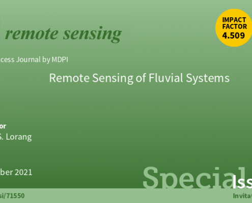
Alex Bonesteel2021-01-18 15:56:532022-09-08 22:01:47Remote Sensing Journal - Special Issue
https://freshwatermap.com/wp-content/uploads/2021/01/fluvial_system_horizontal_dark.png
458
800
Alex Bonesteel
https://freshwatermap.com/wp-content/uploads/2016/10/160408_FWM-Freshwater-Map-Logo-GUIDE.jpg
Alex Bonesteel2021-01-18 15:56:532022-09-08 22:01:47Remote Sensing Journal - Special Issue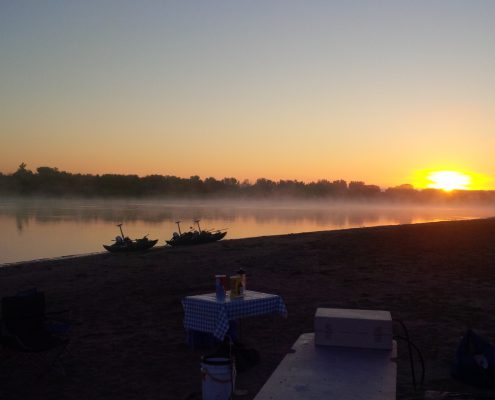 https://freshwatermap.com/wp-content/uploads/2018/05/Missouri-River-Sunrise.jpg
1836
3264
JoeT
https://freshwatermap.com/wp-content/uploads/2016/10/160408_FWM-Freshwater-Map-Logo-GUIDE.jpg
JoeT2018-05-04 20:13:202022-09-08 22:01:53White Paper: High Resolution 3D Mapping of Aquatic Habitat at the River Corridor Scale .
https://freshwatermap.com/wp-content/uploads/2018/05/Missouri-River-Sunrise.jpg
1836
3264
JoeT
https://freshwatermap.com/wp-content/uploads/2016/10/160408_FWM-Freshwater-Map-Logo-GUIDE.jpg
JoeT2018-05-04 20:13:202022-09-08 22:01:53White Paper: High Resolution 3D Mapping of Aquatic Habitat at the River Corridor Scale .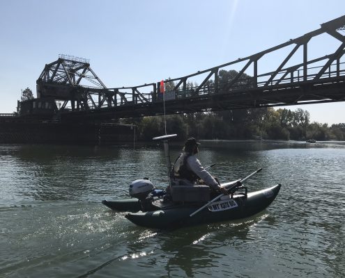 https://freshwatermap.com/wp-content/uploads/2018/04/Sac.jpg
1536
2048
JoeT
https://freshwatermap.com/wp-content/uploads/2016/10/160408_FWM-Freshwater-Map-Logo-GUIDE.jpg
JoeT2018-04-11 22:23:452022-09-08 22:01:58Sacramento/San Joaquin Delta 3D Mapping Project
https://freshwatermap.com/wp-content/uploads/2018/04/Sac.jpg
1536
2048
JoeT
https://freshwatermap.com/wp-content/uploads/2016/10/160408_FWM-Freshwater-Map-Logo-GUIDE.jpg
JoeT2018-04-11 22:23:452022-09-08 22:01:58Sacramento/San Joaquin Delta 3D Mapping Project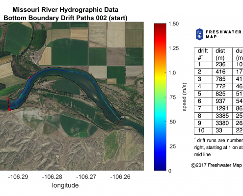 https://freshwatermap.com/wp-content/uploads/2018/01/table_map_segment_002_a_bottom_multi-colored-trails_start.png
2747
4764
JoeT
https://freshwatermap.com/wp-content/uploads/2016/10/160408_FWM-Freshwater-Map-Logo-GUIDE.jpg
JoeT2018-01-09 19:18:282022-09-08 22:02:03Scientific Article - Journal of Applied Ichthyology
https://freshwatermap.com/wp-content/uploads/2018/01/table_map_segment_002_a_bottom_multi-colored-trails_start.png
2747
4764
JoeT
https://freshwatermap.com/wp-content/uploads/2016/10/160408_FWM-Freshwater-Map-Logo-GUIDE.jpg
JoeT2018-01-09 19:18:282022-09-08 22:02:03Scientific Article - Journal of Applied Ichthyology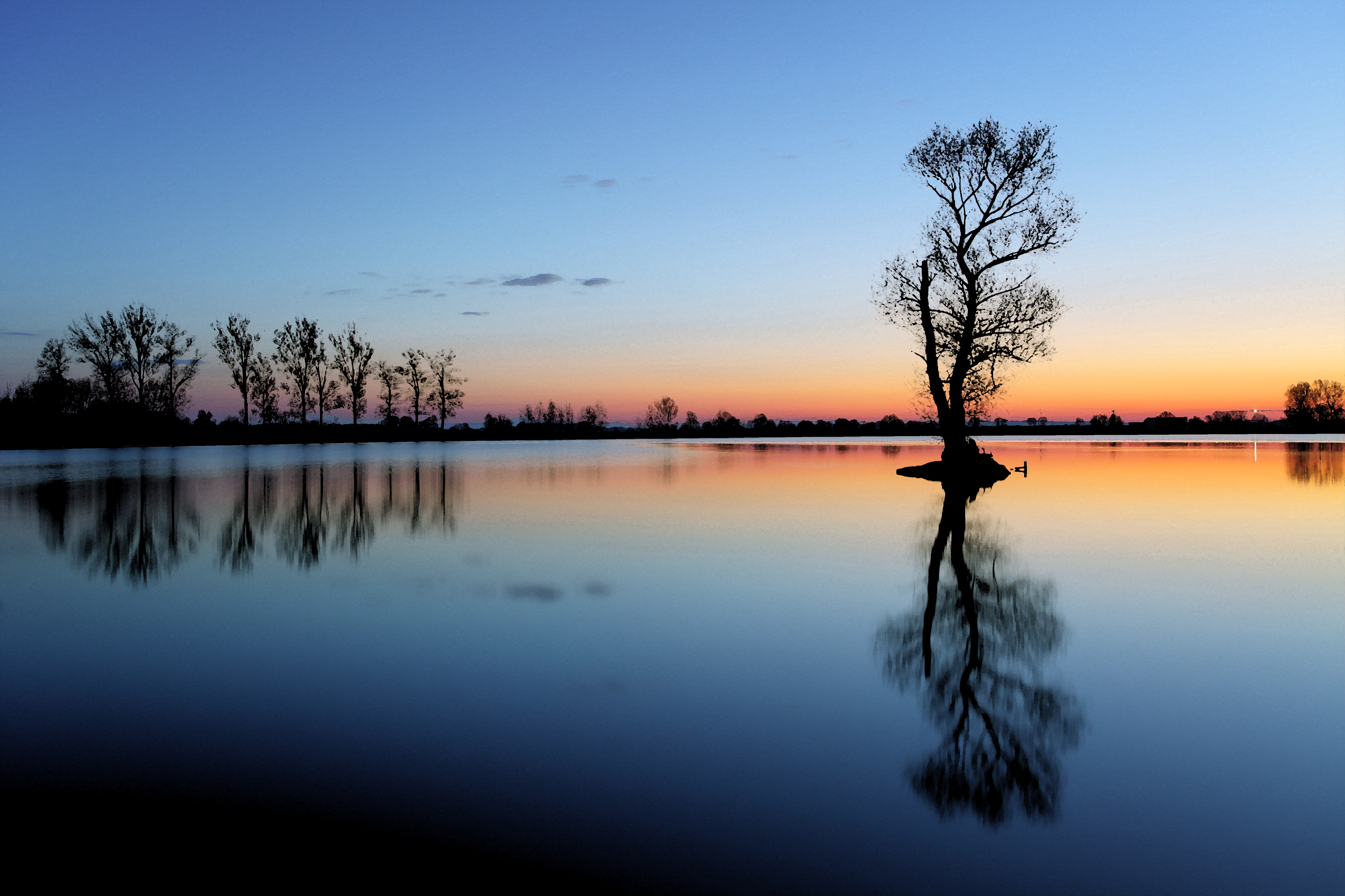 https://freshwatermap.com/wp-content/uploads/2016/02/sunset-3.jpg
3743
5615
JoeT
https://freshwatermap.com/wp-content/uploads/2016/10/160408_FWM-Freshwater-Map-Logo-GUIDE.jpg
JoeT2017-06-30 16:29:022022-09-08 22:02:08Flathead Lake Habitat Enhancement
https://freshwatermap.com/wp-content/uploads/2016/02/sunset-3.jpg
3743
5615
JoeT
https://freshwatermap.com/wp-content/uploads/2016/10/160408_FWM-Freshwater-Map-Logo-GUIDE.jpg
JoeT2017-06-30 16:29:022022-09-08 22:02:08Flathead Lake Habitat Enhancement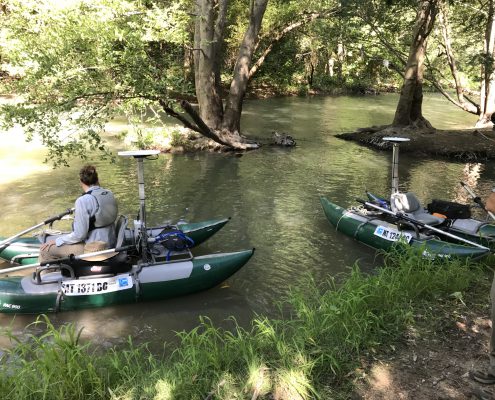 https://freshwatermap.com/wp-content/uploads/2017/06/IMG_0031-1.jpg
3024
4032
JoeT
https://freshwatermap.com/wp-content/uploads/2016/10/160408_FWM-Freshwater-Map-Logo-GUIDE.jpg
JoeT2017-06-29 23:32:362022-09-08 22:02:11Dry Creek, Sonoma County, CA
https://freshwatermap.com/wp-content/uploads/2017/06/IMG_0031-1.jpg
3024
4032
JoeT
https://freshwatermap.com/wp-content/uploads/2016/10/160408_FWM-Freshwater-Map-Logo-GUIDE.jpg
JoeT2017-06-29 23:32:362022-09-08 22:02:11Dry Creek, Sonoma County, CA