Empowering river professionals through data gathering and river mapping

Our team are leaders in the river data gathering and mapping industry

Immense knowledge, unparalleled experience, and a passion for ethical river stewardship are what drive us. Our unifying goal is to provide empirical and detailed data to the river professionals that rely on us.

Dr. Mark Lorang

President and Founder of Freshwater Map

Mark has a distinguished 30+ academic career. As a University professor he taught such topics as Fundamentals of Sediment Transport, Fluvial Geomorphology and Landscape Ecology as graduate courses at the University of Southern California, University of Oregon and the University of Montana, Flathead Lake Biological Station. During this time, he pioneered the use of acoustic doppler profilers and remote sensing as applied to mapping aquatic habitat in rivers.  He has a detailed understanding of how the kind of data that Freshwater Map collects can help address regulated environmental flow issues.   He retired from the University in May of 2016 and formed Freshwater Map with the goal of expanding these techniques to river restoration and optimizing environmental flow regulation.

View Mark’s Full Resume/CV

Brian Marotz

Fisheries Biologist

Brian is the Jacque Cousteau of Rivers. In June 2020, he retired from Montana Fish Wildlife & Parks after nearly 35 years as Montana’s Hydropower Mitigation Coordinator. His career in Fisheries focused on remediating the environmental impacts caused by water management. He completed his BS studying marine science at sea out of Boston University and Woods Hole, Massachusetts. He earned an MS researching estuarine systems on the Gulf Coast at Louisiana State University and the Gulf Coast Research Institute in Mississippi.

Read More

His focus with Freshwater Map will be to help fuse our bathymetric maps of rivers, with their complex 3D patterns of flow and substrate texture measured using our BlueView high-resolution sonar. Brian’s goal is to use those fused data layers to create a River Analyzer-Phabsim model to accurately quantify how aquatic habitat changes with river discharge or reservoir capacity. Brian continues to work with the Columbia River Basin commission to maximize the coordination of environmental flow for dams from the headwaters to the ocean.

Vicki Lorang

Office Manager and Co-Founder

Vicki has a bachelor’s degree in geology and 30 years of project and business management experience. She started working in the environmental field focused on cleanup and mitigation measures for pollution problems caused by leaking underground storage tanks and chemical spills.  She managed the business affairs for Applied Coastal and River Science, a consulting business that eventually evolved into Freshwater Map. She is responsible for contracts, billing and invoicing for all our projects, and handles the HR component of the business. She loves spending time with her family- especially her two grown children as well as floating rivers or walking on the beach.

Dr. William J. Miller

River Ecologist and Aquatic Habitat Modeler

Bill has over 40 years’ experience designing, developing and implementing ecological models for aquatic systems.  He is president and senior aquatic ecologist at Miller Ecological Consultants, Inc. He serves as our advisor helping link our data with computer models to solve problems related to flow regulation.  He has worked extensively throughout the western U.S. and is a recognized expert in the areas of instream flow, water temperature modeling and habitat assessments.  Dr. Miller’s experience includes research and evaluations for several threatened, endangered, and candidate aquatic species in the Colorado River, Platte River, Columbia River, and Missouri River basins. 

Read More

Dr. Miller is a former member of the USFWS Instream Flow Group.  He is co-author on the Stream Network Temperature Model, Instream Flow Information Paper 16.  Dr. Miller has conducted extensive literature reviews on salmonid spawning habitat which included the effects of sediment, dissolved oxygen and water temperature on hatching and emergence success.  Dr. Miller’s dissertation work included the development of a salmonid fry emergence model that accounted for effects of water temperature, dissolved oxygen and sediment composition.  Dr. Miller’s experience includes designing and directing basin wide instream flow evaluations.  He has completed instream flow evaluations for US Forest Service, US Fish and Wildlife Service, Bonneville Power Administration, U.S. Army Corps of Engineers, the U.S. Department of Justice and the Bureau of Land Management.  Dr. Miller developed a GIS based methodology for determining flow/habitat relationships for aquatic species using 2- dimensional hydraulic modeling and habitat evaluations.  Dr. Miller has presented his research at national conferences in the US and international conferences in Japan and New Zealand.

David Meyers

River Team Leader

David is the leader of our Freshwater Map river team and has been with us since day one. He is responsible for oversight of the river team making sure data collection is done properly while maintaining impeccable safety standards. He is a professional kayaker and extraordinary outdoorsman two skills that allow him to both train and lead our team from initial training to maintaining extremely high data collection standards that require the ability to read complex flow patterns in the river make quick independent decisions and then execute precise navigation.

Read More

David is Swiftwater Rescue trained including Wilderness first aid certification. After each trip, he helps with data downloads and processing to further enhance his understanding of our data to improve initial collection to better communicate well with other technicians to accomplish various tasks and team data collection goals.

Jordan Hulla

GIS Specialist

Jordan has been with the company since our first project. Her experience as a raft guide and with Geographic Information Systems, as well as her positive attitude on long wilderness trips, is invaluable. She works both on the data collection side and the data processing/analysis side. Jordan works closely with David to plan each trip and help guide the team down the river to ensure the highest level of data integrity during collection on the river.

Read More

All Freshwater Map data follow the most rigorous QA/QC protocols for data security and analytic assurance. Jordan is charged with that oversight which is a task requiring detailed knowledge of the river and data collection as well as a complete understanding of workings of the hydro-acoustic instruments all the way to applications using River Analyzer and contemporary Arc-GIS platforms.

Diane Whited

Scientist – Remote Sensing GIS Specialist

Diane has spent over 20 years looking at the world from afar and up close through remote sensing technology. Her GIS experience, and desire to share this experience, is so strong that she teaches Advance GIS at the college level. Diane manages Freshwater Maps team of GIS analysts and processing. She and her team are constantly working to improve GIS workflows and QA/QC processes.

Read More

Diane and Jordan work together to constantly improve GIS workflows and QA/QC processes. Diane is also a FAA certified remote pilot holding an FAA license to fly drones both commercially and for research purposes. She teaches drone remote sensing and freshwater science at the University of Montana, Flathead Lake Biological Station. Diane is the co-developer of the Arc-Based and administrator of the Riverscape and Analysis Project (RAP). She has applied this tool to help the Nature Conservancy assess juvenile salmonid rearing habitat. Diane is also Fulbright scholar who used her award to collaborate with colleagues in Switzerland linking river ecology and environmental flow regulation aimed at minimizing ecological impacts from hydropeaking dam operations.

Dr. Mike Roddewig

Scientist – Remote Sensing LiDAR Specialist

Mike received his Ph.D. from Montana State University in 2017, where his dissertation research was on the design and application of airborne lidar to profile lakes and rivers. Mike has been with Freshwater Map since May 2018 as a lidar specialist and scientific programmer. He has deployed his lidar instruments from a small Cessna 185 using it for the detection of fish, plankton, underwater thermal vents, as well as other limnological parameters.

Read More

Dr. Roddewig’s research interests are in coupling lidar data with passive remote sensing imagery to better assess aquatic habitats. Lidar is an essential data source for river mapping and Dr. Roddewig is a leader in cutting-edge lidar technology and brings this expertise to Freshwater Map. In his spare time, Mike spends time with his wife racing their team of sled dogs around Montana. He is passionate about the outdoors and enjoys bringing state-of-the-art engineering to help answer modern ecological questions.

Audrey Thompson

FM River Technician – River Ecologist and Fisheries Biologist

Audrey completed a master’s degree in Systems Ecology from the University of Montana in 2007. Since completing her graduate work studying food web ecology of salmon-producing rivers in Russia, Audrey has focused on behavioral studies of fish in various environments using telemetry technologies. Understanding how fish move within an aquatic environment can be critical information to resource managers, especially when behavior can be analyzed in the context of encounters with dams, diversions, water intakes, other fish, flow fields, behavioral guidance systems, etc. 

Read More

Audrey is a specialist in designing and deploying telemetry arrays to model fish and animal behavior across various spatial scales in both 2D and 3D space. She has worked on a variety of species including Pacific and Atlantic salmonids, sturgeon, Pacific Lamprey, Silver eels, crustaceans, and others in the United States, Canada, and Europe.

View Audrey’s Website Here: https://adiposegroup.com/president

Kim Lindstrom

 FM River Technician – GIS Specialist

Kim has been with Freshwater Map since the start up helping organize logistics for trips, collect the data, store, manage and process that data producing maps and analysis of flow for all our past projects. Her skills as an experienced rafting guide and GIS professional have really helped FM provide quality data and data products. Kim grew up surrounded by lakes and wetlands in northern Minnesota.  Guided by her love for maps and a desire to explore new landscapes she moved to northwest Montana and began working as a cartographer/GIS analyst.  

Read More

Kim has collected, processed, and analyzed a wide variety of data including hydrography, fisheries and wildlife distribution, city utilities, and emergency access networks.  Kim has worked as a pro ski patroller for over a decade where she has honed her safety and rescue skills.  In her spare time, she enjoys floating rivers and skiing different mountains.  She aspires to explore more rivers and mountains on other continents.

Rob Millspaugh

FM River Technician and Swiftwater Rescue Trainer

Rob began his water career rowing, canoeing, and water skiing on the lakes and rivers of New York State.  Lured by steeper skiing and boating, he attended the University of Colorado at Boulder and received a bachelor’s degree in Environmental Engineering with a focus in water treatment and remediation.  Since then, Rob’s work experience has included working on rural wastewater treatment projects in Nepal, brewing beer, raft guiding, composting, snowmobile guiding, firefighting, managing state forests, making pizzas, and interning with the local avalanche center.  He is also currently active with the Whitewater Rescue Institute where he assists with Swiftwater Rescue training and remediation of petroleum spills. Rob enjoys operating vessels of all kinds, wrestling with dogs, and making “circle foods.”
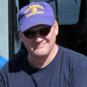
David deRoulhac

FM River Technician and Environmental Consultant

David deRoulhac is an environmental consultant and contractor with over 20 years of experience in federal and private contracting in the western U.S.  Over the last 10 years, he has worked for several conservation and research organizations collecting data on rivers, soils, forests and grasslands for research companies, non-profits, and various federal agencies.  He owns and manages Roan & Associates, a company that conducts forest vegetation collections and forest inventories for the USFS in most western states. David holds a Master’s of Natural Resources and a NEPA graduate certificate.  He brings a diverse skill set with expertise in biological data collection, environmental policy and project management.


Maranda Stopol

FM River Technician – River Guide and Whitewater Professional  

Maranda grew up on rivers and has pursued the life of a whitewater professional. From exploring rivers and expedition kayaking around the world to sharing her passion for the outdoors with others as a river guide, Maranda is an advocate for healthy watersheds and river stewardship. She studied ethnoecology, with a focus on watershed interconnectivity. Additionally, Maranda is trained in Advanced Swiftwater rescue and has experience as a Remote Wilderness EMT. 


Liz Poole

FM River Technician – River Guide and Kayak Instructor

Liz grew up in Northwest Montana, as the youngest of nine, she spent her time as a kid attempting to keep up with her seven older brothers in every outdoor adventure they would try. She obtained her bachelor’s degree from the University of Montana and has since then made a career of providing river experiences to others while focusing on the therapeutic nature hidden within outdoor pursuit.

Read More

She has been involved in the whitewater community for nearly a decade. From river guiding to kayak instruction, she is well versed in river safety, education, and group management.  She has paddled rivers spanning the entire Northwest and professionally guided over 6,000 river miles. Her current certifications include Swift Water Rescue Technician, Wilderness First Responder, and ACA Level 4 Whitewater Kayak Instructor. It is her love of rivers coupled with her depth of experience that has caused Liz to seek out opportunities that can protect and save rivers for the generations to come.

Fletcher Anderson

 FM River Technician – Fireman and Paramedic/EMT

Fletcher is one of Bigforks Fire Departments full-time Paramedic/FFs working 24-hour shifts. He also works for Blacktail Mountain Ski Patrol in the winter months and Freshwater Map when the trips are available. He has been in emergency medical service or the last 16 years. In his off-time Fletcher enjoys overlanding in his pickup, finding the offbeat trail, camping along the way and building his rig to better suit the adventures it takes him on.  “Having grown up in Bigfork, I feel privileged to get to work and play in the careers that I am a part of, in the community and area of the world that I love.”

Devon Thompson

FM River Technician – Fisherman and River Enthusiast 

Devon lives in Montana and rivers are it for him. He grew up in the Pacific Northwest which instilled a love for water and wildlife and after moving to the Rockies, his passion for rivers and conservation grew. Devon has been rowing for Freshwater Map since our first trip on the Missouri River in 2016. And he participated in all our subsequent trips across the West with each section of river mapped being remarkable and unique. Devon says: “that because of the nature of the work, we get to experience rivers in an entirely new way. Our crew is an amazing combination of skilled and talented people. Each brings something valuable to the table, and I feel so fortunate to be a part of this team. Now, I am so excited to be a part of the crew as we prepare for another trip on the Missouri River in June of 2021.”

Field Data Gathering & River Mapping

Contact Us to Learn More About Our Services

© 2017 Freshwater Map. All Rights Reserved | Custom Web Design and Development by Alex Bonesteel