Kootenai River, MT and ID
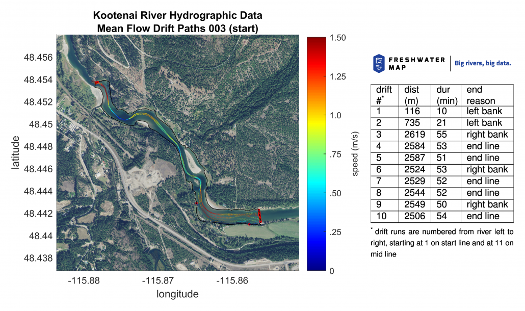
Kootenai River, MT and ID — Freshwater Map collected and analyzed data from Kootenai Falls to Moyie Creek to help MTFWP determine why white sturgeon and multiple other endangered species in this reach are not reproducing in the wild. This drift map, which shows the paths of sturgeon embryos in the river, helps biologists determine the optimum water release from Libby dam when endangered sturgeon are spawning. We have generated these, as well as bathymetry, and flow velocity maps, for 50 km (30 miles) of river. These maps help wildlife managers determine abundance and location of juvenile rearing habitat at varying flows to help this endangered species succeed. This work, together with the decades-long work being done by the Kootenai Tribe of Idaho, enables wildlife managers to view the Kootenai River as an entire system as it winds from Libby Dam into the cross-border Kootenay Lake.

